
The Guardian recently published a fascinating story, Revealed: Cambodia’s vast medieval cities hidden beneath the jungle, about the discovery of huge city complexes near Angkor Wat. The temples of Angkor are built of stone, but these structures are roadways or wooden walls and so are far more perishable. The Khmer Empire collapsed around 1300 CE, so they’ve been lost under vegetation for some 700 years. It’s impossible to see them while traipsing through the jungle, but a remarkable new technology, Airborne Laser Detection And Ranging, can see them from the air:
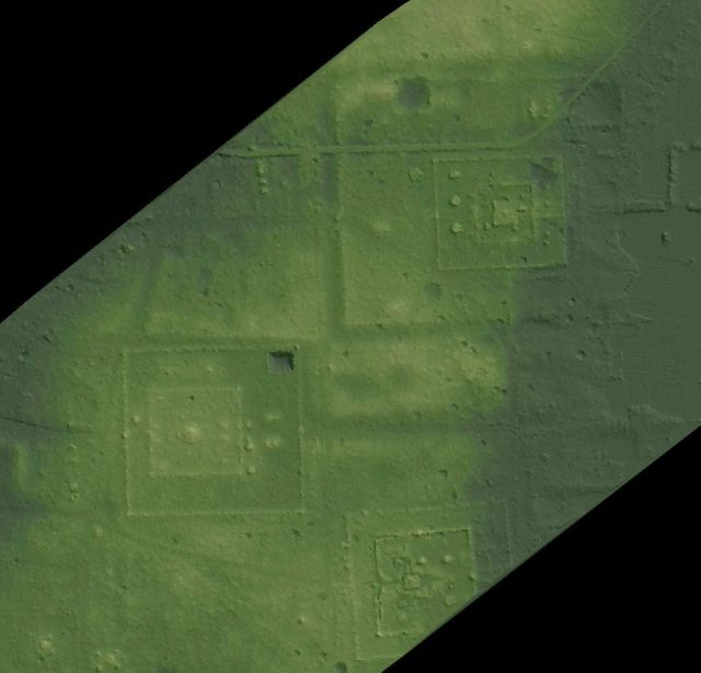
Archaeologically-significant topography around the central brick towers of Sambor Prei Kuk. Courtesy McElhanney. Click for site
The paper describing the work is here: “Airborne laser scanning as a method for exploring long-term socio-ecological dynamics in Cambodia”. It says this is the biggest lidar survey ever for archaeology.
Airborne lidar was developed in the late 90s. It works by mounting a laser and a highly sensitive infrared photodetector on a helicopter. The laser shoots out 120,000 pulses per second, and the sensor times how long they take to echo from off of the ground. The helicopter flies at about 800 m, so the pulses take about 5 microseconds to travel down and back, which is what limits the pulse rate. The laser is scanned across the landscape by a mirror cycling at 200 Hz, and you end up getting at least 16 pulses per m². The timing is accurate enough to distinguish delays down to about 15 cm of height resolution. The laser’s position is tracked by GPS supplemented with inertial sensors. The result is a 3D map of a landscape.
Most of the pulses will bounce off the tops of trees, which aren’t that interesting. Some fraction, though, will get through the leaves and bounce off the ground. This lets one see the actual ground level through all the shrouding jungle. They did the scan in March 2015, when the leaf cover was at a minimum. Here’s a cross-section of one strip of their data:
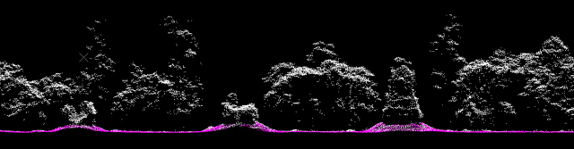
Pre-Angkorian towers of Sambor Prei Kuk among the trees. Courtesy McElhanney
By filtering the pulses by height, one can find the ground elevation over square kilometers at a time. This actually takes a lot of processing, since huge amounts of data get collected, so the systems come with GPUs. It’s carefully compared to ground surveys, and visible light images taken at the same time as the scan. Angkor Wat itself is the most important archaeological site in Southeast Asia, and so has been heavily surveyed, so it makes a good reference.
The project is called the Cambodian Archaeological Lidar Initiative, and is a joint project between institutes in Cambodia and France. It’s led by Prof. Damien Evans of the University of Sydney. They did an earlier, smaller run in 2012. The survey itself was done by a Canadian company, McElhanney, which has done this kind of geographic information work all over the world since 1910, largely for forestry and mining interests. The lidar is a Leica ALS70 (now replaced by the ALS80, which has a faster peak pulse rate). It’s generally used for city surveys.
Well, finding lost cities is pretty cool. How can this be creepy? Hmmm, what else is hidden under forest canopies? Drug operations. Whether it’s marijuana farms in the Pacific Northwest or submarine construction in Columbia:

30 m sub seized by the Columbian army in 2011
It won’t be possible to hide things on the land any more. Not only can lidar see through trees, it can detect a camouflaged tank from its shape. Operations like the above will have to be done indoors or underground.
And airborne lidar is getting easier to do all the time. A Lincoln Labs spinoff in Massachusetts, 3DEO, has developed a much more sophisticated sensor than this Leica one using DARPA money. It can detect a single photon of infrared light using a circuit called an avalanche photo-diode, and measure the return time down to a nanosecond. It can do this for 4K pixels at once, and so can scan at a much higher rate than the Leica.
The size and power of the systems are also constantly improving. The Leica weighs 90 kg and takes 900W, and so needs to be on a real plane or helicopter. Cut these by a factor of 20 and they can go on a drone. The size reduction will be driven by use for automotive sensing, where lidar is a good complement to radar.
With cheap, fast scanning there are scads of other interesting things one could do. You could scan all the farms in a state every week to learn how crops are growing. The depth of the snow pack could be constantly measured over the entire Rockies, and the height of every lake. You could scan all the streets of a city every morning to find out where obstructions were in order to tell self-driving cars to avoid them. Count all the cars on a highway or in parking lots! Count all the sheep on a moor, or elephants on the veldt, or Taliban in Afghanistan!
Everything everywhere can now be tracked. Sound creepy? Sure, but it can be cool too.
